
The next day already was our last full day of dog sledding.
The day started out nice again.
It looked as if we would have another day of good dog sledding. And as any such day should, it started with some making water for hot drinks and having a big breakfast before striking camp and getting the dogs ready to go.


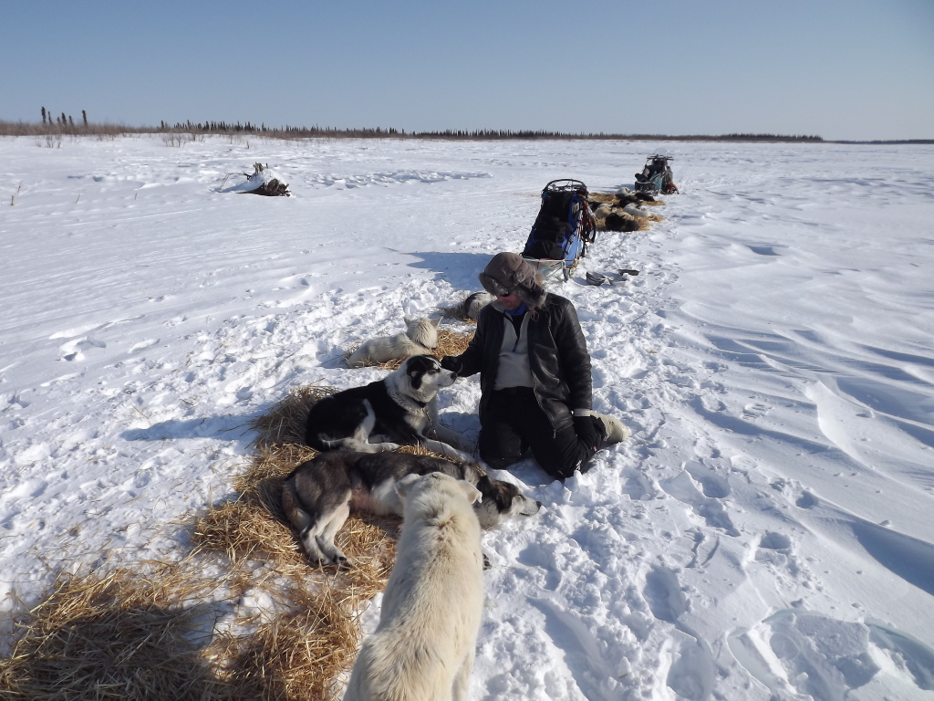
The only difference from the normal routine was that I had to put 'socks' on Justin.
Some dogs (such as Justin) have a furless spot on the inside of their 'wrist'. This usually is irrelevant, but in certain conditions (such as a thin layer of crusty snow on top of a thick layer of powder snow, where the dogs push deeply through the crust), that spot can get chafed.
To avoid that, the dog not only gets a bootie, but also a 'sock', where the bottom of a bootie is cut open and pulled high up the leg before putting on the regular bootie. It looks a bit silly, but luckily the dogs don't know that.


We soon were on our way again and the dogs clearly enjoyed themselves. (Even the one with socks...)


For most of us, it was a nice, easy and enjoyable day of dogsledding.


For most of us.
Constanze, however, was having an interesting day. Both of her female dogs came into heat and it became increasingly difficult to keep her male dogs focused on the trail. One of her leaders, Sirius, would run a couple of hundred meters and then stop, turn around and check out the females (who were running in single on wheel and directly in front of wheel).
While doing so, Sirius (and the other leader, Basil, who got dragged along) needed to pass by the swing dogs (which already means possible trouble) and also wrapped the gangline around them (which means more potential trouble and risk to the dogs). And while usually the collective noun for a group of dogs is a pack, in this case terms like heap or tangle might have been more appropriate.
The first couple of times, Constanze was able to sort it out alone, but during the day the dogs became more determined (and the swing dogs more irritable), so it took three of us to get the dogs sorted out, the lines disentangled and the lead dogs pointed in the right direction again. At least for another couple of hundred meters.
In the late afternoon, the unplanned stops became too frequent and we did only make slow progress along the trail, so something needed to be done.
In the end, a rope was attached to the neck line between the leaders and Alan (who was riding the sled in front of Constanze) 'towed' her sled, so that her leaders could follow him, but couldn't turn around and get back to her wheel dogs. It's not that obvious, but on close examination, Alan can be seen holding the rope in his hand.

After a nice relaxed (for most of us) or a nice-but-stressful day of dogsledding we reached Edward's cabin.


Edward wasn't there (he was visiting some relatives in Inuvik) and, unfortunately, the blizzard had blown a big pile of snow into his doorway, so that Frankie (who already had done more than his share in shovelling snow) had to move another couple of tons of snow.
While Frankie and Gerry were taking care of the snow, we were taking care of the dogs, doing all the usual things, like putting down straw for them...

...feeding them...


...taking care of their paws by putting zinc oxide cream on them...

...and telling them that they have done a good job today. (Not that it means anything to them, but it feels like the right thing to do.)
Next to the dogs, there were some paw prints that weren't from dog paws.
Obviously, a wolf had been checking out the place while we (and Edward) were away, probably to have a look whether any dog food was still lying around somewhere. However, we didn't see any wolf when we were there.


The only wild animal that was about was an eagle that was watching us from a tree. (There was also a jay/magpie around sometimes, but as that had its own 'feeding tray' nailed to a tree nearby, I'd consider it semi-domesticated.)

After the dogs were cared for, it was time to retire to the comfort of the cabin and have dinner ourselves.


Next morning we could afford to sleep a bit longer than usual.
We only needed to sled from the cabin to the ice road (about half an hour of sledding), so there was no real need to hurry.
As it was also the last time we would all be together (Frankie lives in the Aklavik area, he would drive home with his snow mobile directly and not come to Inuvik with us), it was also time for some group pictures.


Getting the toboggans properly packed and everything on them secured took a lot of time each morning and as the ice road was only minutes away for a snow mobile, it was faster and easier to just load half of the stuff on the toboggans, drive that to the ice road, unload it there and come back instead of packing all of it and driving only once.


So the 'snow mobile convoy' left first and we started to get ready to leave as well, putting on harnesses, doing booties (including socks, again) and raking snow to make the place look tidy again


The dogsledding itself lasted only half an hour and was eventless (Constanze's lead dogs were again in tow by Alan, so there weren't any unplanned stops there), but at least we had some light wind from the back at about the speed we were sledding, so while being on the move, there wasn't any noticeable wind and I got my chance of doing dogsledding in a t-shirt. (Although I donned jacket and sweatshirt quickly after we stopped)

When we arrived at the ice road, it wasn't quite there yet.
The blizzard had blown a lot of snow onto the road, so the ice road had been closed for a couple of days. They were in the process of using bulldozers to remove the snow and make the road usable again.
We were a bit lucky here, since they had just reached the point of the road where we planned to meet up with the trucks and the van and load everything to drive to Inuvik.


But it took a while until the vehicles could use the road and drive to our position, so we had some time to hang around and play with the dogs.


Eventually the vehicles arrived and it was time to get everything packed on the trailers and into the van - which took a surprisingly long time, especially since we came back with less stuff (especially human and dog food) than we started with, so there should have been more room available...

Finally everything was loaded and we drove down the ice road and back to Inuvik.


After being out for about ten days, we all looked a bit scruffy and needed some time at the hotel to get back to our civilized selves. (There's always a bit of hope that you look a bit roguish and cool, but looking into the mirror, there's the realization that the only look achieved is that of some homeless bum. Time to shave...)

Since we turned around early, we arrived in Inuvik a couple of days earlier than expected (even though we spent three days in the blizzard). As the weather was fine for the next couple of days, it might have been fun to do some day tours with the dogs (near-empty sleds, easy going, no need to set up camp in the evening), but it never came to that.
From a dogsledding point of view the trip was over.
Frank wanted to get back to Whitehorse as quickly as possible.
There was a bit of a snag, though.
The Dempster Highway, the only street connection between Inuvik and, basically, everywhere else, was closed. The blizzard had blown in a lot of snow there as well (and as the bad weather area had moved from west to east, it got hit by the blizzard after it had left us) and it hadn't been cleared yet. So everyone was stuck in Inuvik and it was not clear how long this would be the case. (Although for me it was simple - as I wasn't planning to drive down to Whitehorse anyway, I had a flight booked from Inuvik to Whitehorse, so regardless of the state of the Dempster Highway, I would be flying out a couple of days later.)
But the Dempster closure put a damper on any proper planning. The idea was, roughly, to get on the road as quickly as possible when it was open again. And any day tours might have interfered with that (the Dempster might have opened when we were 'out there' somewhere), so the daily routine was reduced to taking the dogs out of the trailer four times a day and feeding them twice a day.
At least it gave us a chance to get the gear that was still in the sleds sorted out and separating booties, dog codes, wires, harnesses, sleeping bags, sleeping pads, mittens, tug lines, thermos, bagels and all the other stuff.


And on the third day, four of us (Peter, Gerry, Alan and me) could do a day tour, even though it was not a dog sledding tour, as we took the van. (Constanze needed to stay behind to help Frank with the daily dog handling chores.) As luck would have it, that turned out to be the day where the Dempster was opened again, although in the end that didn't make any significant difference.
The destination for the day was Tuktoyaktuk. While the only 'real' road from Inuvik is the Dempster Highway, in winter there's also the ice road along the Mackenzie River. And there is only one junction on the road - one road leading to Aklavik (where I've been in 2009 and also the road we took towards Edward's cabin) and the other leading to Tuktoyaktuk, which is the northernmost place in Canada that you can drive to (at least in winter - in summer you can only get up to Inuvik), so it's quite literally at the end of the (ice road).

As it's about 190 km to drive to Tuktoyaktuk (one way), it's about the right distance for a day tour. As a bonus, Gerry was coming with us and he had grown up there and also served there (when he was in the RCMP) for a couple of years, so he knew a lot of people up there (given the small size of the place and the fact that he knows people in the North anyway, he probably knew everyone) and could provide lots of information and narrative.
And there was another reason to drive up the ice road - it might have been one of the last opportunities to do so. And that has nothing to do with climate change (at least not directly) or the difficulty of maintaining the road in winter. The reason is that they are building a permanent road (extending the Dempster Highway) between Inuvik and Tuktoyaktuk. (In fact, a lot of the traffic going up the ice road that winter consisted of road building equipment, since they are building the road from both sides.) And once the permanent road is completed, there's no reason for preparing an ice road between the places any more.
So there might not be that many more chances to drive the ice road to Tuktoyaktuk, which was another incentive to do it now.
Driving the Inuvik-Tuktoyaktuk section of the ice road was pretty much the same as driving Inuvik-Aklavik, although the road was mostly a lot wider, as more space was needed for the big trucks. The road also became a bit rougher in the final section leading to Tuktoyaktuk, as it leaves the river delta and continues on the Arctic Sea, where there is more tidal and wind related movement of the ice layer. But all in all, it was surprisingly smooth going. And even though the van didn't have four wheel drive, we didn't encounter any problem.


One of the reason for the easy drive was that large parts of the ice road had just recently been maintained. The blizzard had affected parts of the road to Tuktoyaktuk as well, so everything had just been cleared of snow. Obviously it was sometimes easier to make a new road than remove the snow from the old one (presumably because it's easier to push snow to the sides when the sides don't already consist of packed snow), which sometimes led to traffic signs in places where there wouldn't be traffic anymore.


We also did see some wildlife visible from the road, such as this fox.

Tuktoyaktuk itself is currently in a slightly dormant state. There was a big oil boom about a decade ago and people made good money, but it has gotten too expensive to get more oil out, so the local economy declined. But as oil prices rise, it might become profitable to extract oil again, so facilities haven't been dismantled, but were just mothballed.

After two hours of driving we made it to Tuktoyaktuk. (Some time ago it was called 'Port Brabant', put then the original name was (sort of) restored. But they didn't quite use the Inuit name, but an anglicized version of it, which probably even the Inuit prefer, since it's a couple of syllables shorter. But then again, maybe not, as everyone refers to it as 'Tuk' anyway.)

We stopped at the end of the road for a picture. From here on, there's only the ocean between us and the North Pole. (Which is a bit less impressive once you realize that there are bits of coast in Morocco where this is true as well, but we still had that 'End of the World' feeling.)

And after we arrived at the end of the road, we went to see the start of a new one.
Work on the road to Inuvik had already started and while the signage was still a bit temporary, this is where it begins.

And Tuktoyaktuk is not just the end of the road for cars. The Trans Canada Trail ends here as well - at least one arm of it. The main trail reaches from St. John's in Newfoundland to Vancouver Island, but there is a side arm branching off in Calgary that leads to Tuktoyaktuk, making the trail coast-to-coast-to-coast.

We did a couple of hours sightseeing in Tuktoyaktuk, which has some odd contrasts - cute fluffy dogs, an oil exploration platform that would make a good fortress for some movie villain, collections of caribou antlers, a run down hovercraft and some snow inuksuk (up there, you just don't have simple snowmen, but do it with more style).


Next to the quay there were some strange lines bulldozed into the snow, as there was a local celebration (called the Muskrat Jamboree) during the following weekend and they were preparing the snowmobile racing track.

We also had a quick look (but didn't get close to it) at one of the large pingos outside of Tuktoyaktuk. Pingos are a geological oddity. They aren't really hills, even though they look like one on the surface. Mostly they are ice that gets pushed upwards by freezing water. If there's some water below the soil, it will freeze in winter and, as it expands, pushes the soil upward. If the ice then doesn't melt in the summer, but some more water gets under it (from a lake or ground water), that water will then freeze in winter and push the whole thing further upwards. Repeat that for a couple of centuries and you get fairly impressive looking hills. Geologically speaking, you just get a landscape with pimples.

An unusual feature of Tuktoyaktuk is the communal freezer. While nobody really needs a freezer in winter, it is useful for storing things in summer. As Tuktoyaktuk is on permafrost ground, only the surface thaws in summer. Once you get a couple of meters below ground, temperatures remain below freezing.
So some 'mine shafts' have been driven through the frozen grounds. From these mine shafts, some chambers branch off to the sides, which are then used as walk-in freezers.
On the surface, there's just a little wooden shack. In this there's a ladder that leads about ten meters down.


Down there, you find the individual shafts branching off, with small wooden doors leading to the (individually owned) freezer rooms. (The walls look a bit like marble in the pictures, but there's surprisingly little soil involved. The dark bits are mostly ice. It's just the way that the ice reacts to the camera flashlight that makes it look dark.)


After we were back at the surface, we visited a local bear hunter (or, more often, a bear hunter guide) who was preparing his gear for the season (as he would have grizzly hunting clients the next week) and hung around for some coffee and stories before heading back to Inuvik.
On the way back, we managed to spot another fox.

When we arrived in Inuvik in the evening we got the news: The Dempster Highway is open.
The plan was (for everyone but me) to leave Inuvik and head for Whitehorse the next morning at 8 am. (My flight would be in the afternoon the following day.) So there would be an early wake-up call for 6 am to get the dogs out of the trailer, feed them and clean up behind them, as they would be in their boxes on the trailer for quite some time while being on the road.
My presence wasn't really needed, but as this was the point where out paths would diverge, it seemed just right to get up early and say good-bye to people and dogs.
As I didn't have anything else to do that morning, I went right back to my hotel room after everyone had left and got some more sleep. When I got up around 11 am, I checked the status of the Dempster and noticed that it had been closed again around 9 am, about 350 km away from Inuvik.
I almost expected them to be back in Inuvik in the evening. But I also assumed that it would be unlikely that, if they had driven 350 km south, they would just turn around and drive back, but probably would just sit it out.
I had a nice flight the next day. It was on time, and there were clear skies all the way.
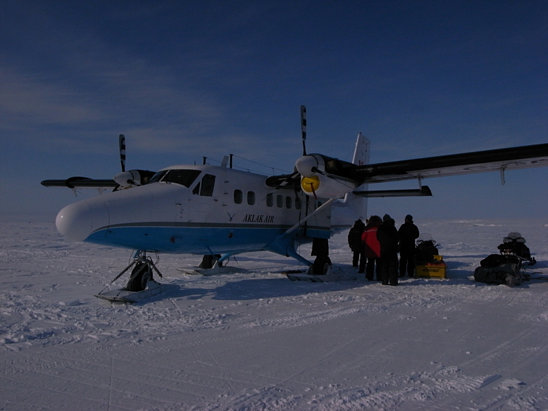
At the airport I also encountered, technically, an 'old friend', an Aklak Twin-Otter. While they had changed the colour scheme (now it was blue on white), the licence number showed that it was the same plane that had brought me to Herschel Island back in 2009.
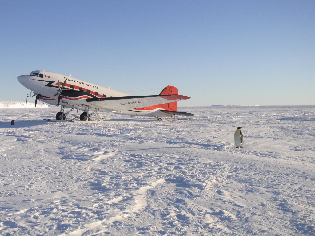
(I wonder whether there also was another plane I knew, since there was a Kenn Borek Air Basler at the airport when I arrived there, which might have been the same one that took me to the emperor penguins, but I didn't get a look at its licence number, so I'm not sure.)

One more look at back at Inuvik airport, directly after take-off.

As the weather was nice, there were some good views of the Yukon landscape.

A short stop at Dawson City Airport...

...and then onward to Whitehorse.

For me it was a quick and easy trip from Inuvik to Whitehorse. For the others - less so...
While this is all second-hand information, this is essentially what happened to them.
They managed to get to Fort McPherson until they found out that the road was closed from there on. Frank then decided to give it a try anyway and they proceeded down the Dempster. But the problem was not only that the Dempster had recently a snowstorm and wasn't quite cleared yet, but also that another blizzard was coming up
So they drove right into it until lack of visibility forced them to stop - at which point they noticed that the trailer was missing a tire (there are double tires on each side of the trailer, so it's not immediately noticeable - still, nobody had seen it coming off). When they were able to go on, they just managed to get another 25 kilometers before the other (now single) tire blew. There was one spare tire, but that was only half-inflated. They tried using that, but that made it only a short distance before it fell apart as well, this time taking part of the wheel with it. So even with new tires, the trailer was beyond 'on the road' repairs.
And since the trailer was broken, they couldn't just ask someone else to pull it (if the truck had been broken, they might as well asked someone else to pull the trailer - almost everyone has a truck hitch on his van). Also, if it had just been the trailer with the snowmobile, all the gear could have been transferred to some other truck. But they couldn't just put 28 dogs somewhere - they needed to be transported in a dog trailer.
So they had to call in another musher (actually two) with a dog truck to drive up the Dempster to their position and bring the dogs to Whitehorse.
So while I had a pleasant flight to Whitehorse, they went through quite a lot of trouble (and, I've been told, that's only the condensed version of it). It was a bit of a continuation of the trip so far - nothing bad happened in the end and it all worked out, but there was a lot of adversity to overcome.
Unaware of their problems, I had a nice day in Whitehorse.
As I had been in Whitehorse before, I had hired a car to be able to see some attraction outside the town, but it was a nice morning and there was a hiking path along the river (the Millennium Trail) with the option to continue along the Yukon River Loop Trail to Miles Canyon. So instead of driving somewhere and then take a walk from there, it seemed easier to just start walking directly. (Which made the car hire the most pointless one I ever did - I just drove the short distance from the airport to the hotel and back again.)
The path starts at the Klondike sternwheeler (well, it's a loop walk, so it doesn't really start anywhere, but that it where I entered the loop).

Spring started to arrive in Whitehorse but hadn't quite made it yet, so there still was a lot of ice on the Yukon, but also a fair number of open leads.


I also passed the second 'airport' in Whitehorse, the float plane base at Schwatka Lake, but that also wasn't quite operational yet.


From there I walked to the next bridge at Miles Canyon and walked back to Whitehorse on the other side of the river. An easy 20 km walk without any problems and hitches.

